
Wasatch Backcountry Skiing Map
Wasatch Backcountry Skiing Map generates an estimated $1k–$20k/month in revenue from 200–1k downloads/month on the App Store, according to AppCurrents estimates (updated 2026-08-02).
| Est. revenue / month | $1k–$20k |
|---|---|
| Est. downloads / month | 200–1k |
| Estimate confidence | medium |
| Pricing | Paid $12.99 |
| Rating | 4.71 ★ (502 ratings) |
| Category | Navigation |
| Best chart rank | #46 Navigation Paid |
| Released | 01.10.2013 |
| App last updated | 10.07.2026 |
| Platform | iOS |
Modeled monthly estimate · rating velocity · medium confidence

About
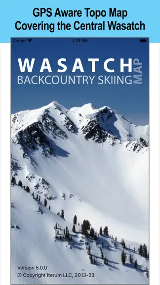
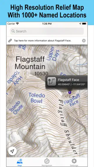
The Wasatch Backcountry Skiing Map is the iOS version of the popular paper map and website (visit WBSkiing.com). As with the other platforms, the iOS map includes an index to more than 1,000 backcountry locations in Utah's Central Wasatch mountains (i.e., the two Cottonwood Canyons and some surrounding areas). Visit https://wbskiing.com/coverage to see the terrain covered by this map. This is the…
Trends & analysis
Chart rank trend
US · categoryWhy it's surfacing
Scout 16Ratings & velocity
★ 0 in windowRating distribution
93% positive · 500 ratingsGeographic reach
best rank · 1 storefrontRevenue & downloads trend
ARPU $9Update history
2 updates tracked- v5.0.025d ago
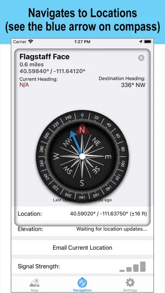
Everything you love about Wasatch Backcountry Skiing Map, now dramatically better. Version 5.0.0 is a ground-up redesign built for modern iOS: a sharper, more detailed map, faster and more reliable navigation, smarter search, and a cleaner waypoint experience that makes marking and finding spots effortless. Every screen has been rebuilt to be more responsive and intuitive, with enhanced iPad support that takes full advantage of the bigger display. The contour lines and slope shading in version 5.0.0 are based on high-resolution LIDAR data, increasing the detail of the contour lines and relief shading dramatically. Improved accuracy of the "30-degree slope shading" makes understanding terrain easier than ever. Version 5.0.0 also added more than 50 waypoint names and improves the location data on hundreds of waypoints.
- v3.5.08.6y ago
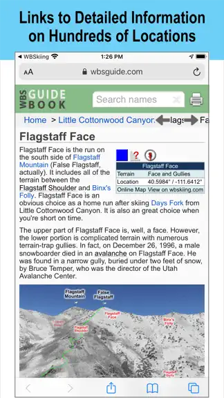
This update from Apple will improve the functionality of this app. No new features are included. Version 3.5.0 is now linked to the Wasatch Backcountry Skiing Guide. After selecting any of the hundreds of linked-locations in the app and tapping on the "Tap here for more ..." box, photographs and detailed information about the location such as skiing difficulty, skinning distance, vertical climb, altitude, aspect, and slope angle will be displayed in Safari (see screenshot). You can tap on the "WBSkiing" text in the top-left corner of Safari to return to the app. Version 3.5.0 also has a new base-map with dozens of additions and improvements. As always, it's a free upgrade.
Wasatch Backcountry Skiing Map — FAQ
How much money does Wasatch Backcountry Skiing Map make?
According to AppCurrents estimates, Wasatch Backcountry Skiing Map generates approximately $1k–$20k per month (medium confidence), modeled from its the App Store chart performance, rating velocity, and monetization signals.
How many downloads does Wasatch Backcountry Skiing Map get?
Wasatch Backcountry Skiing Map sees an estimated 200–1k downloads per month on the App Store, per AppCurrents modeling.
Is Wasatch Backcountry Skiing Map free?
Wasatch Backcountry Skiing Map is a paid app priced at $12.99 on the App Store.
What is Wasatch Backcountry Skiing Map's rating?
Wasatch Backcountry Skiing Map holds a 4.71-star average from 502 ratings on the App Store. It currently ranks #46 on the Navigation paid chart.
When was Wasatch Backcountry Skiing Map released?
Wasatch Backcountry Skiing Map launched on the App Store on 01.10.2013. Its latest version shipped 10.07.2026.


