
Topo Maps+: Topographic Maps
Topo Maps+: Topographic Maps generates an estimated $2k–$12k/month in revenue from 5k–22k downloads/month on the App Store, according to AppCurrents estimates (updated 2026-10-02).
| Est. revenue / month | $2k–$12k |
|---|---|
| Est. downloads / month | 5k–22k |
| Estimate confidence | medium |
| Pricing | Free + IAP |
| Rating | 4.73 ★ (9,361 ratings) |
| Category | Navigation |
| Best chart rank | #70 Navigation Grossing |
| Released | 30.07.2013 |
| App last updated | 14.09.2026 |
| Platform | iOS |
Modeled monthly estimate · rating velocity · medium confidence

About
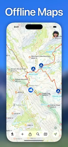
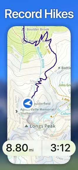
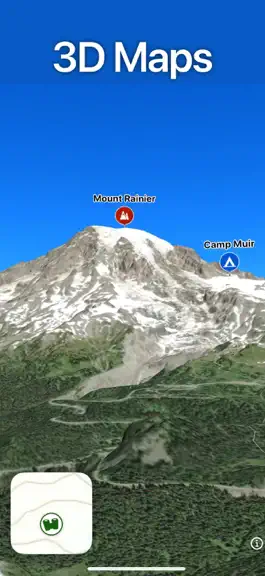
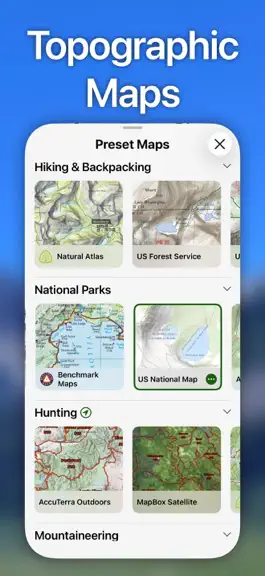
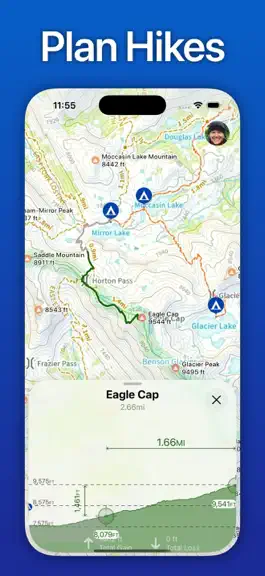
Designed and tested on real dirt, Topo Maps+ is packed with the maps & tools to plan and execute your backcountry adventure. ‣‣ MAPS FOR EVERY ACTIVITY ‣Setup your map based on your planned activity ‣‣ PLANNING TOOLS ‣ Compare and Download maps for use offline. ‣ Combine overlays to customize your map view ‣ Smart route-building tools ‣ Waypoints ‣ Print, email or share custom maps and routes ‣…
Trends & analysis
Chart rank trend
US · categoryWhy it's surfacing
Scout 30Ratings & velocity
★ -0.01 in windowRating distribution
96% positive · 9k ratingsGeographic reach
best rank · 1 storefrontRevenue & downloads trend
ARPU $0In-app purchases
10 tiersUpdate history
8 updates tracked- v10.2.318d ago
Support for iOS 27.
- v10.2.224d ago
Snap to Trails now works offline. Trail routing runs entirely on your device, so you can build routes that follow trails with no cell service — and it's much faster. New MGRS grid overlay — grid zone designators plus 100km, 10km and 1km squares, with labels that keep the zone. New distance grid overlay — square grids from 100 yards/meters up to 50 miles/kilometers, for quick distance estimates on the map. Export options to include elevation in GPX and KML tracks and routes. Fixes: - printed maps now use the correct fixed scale when your text size isn't the default - printed maps label trails along the trail line far more often - hill shading draws above imported maps and overlays; data layer attribute changes sync correctly - faster and more reliable loading for large teams - fixes for map tiles and photos that sometimes failed to load - several crash and stability fixes.
- v10.2.11mo ago
• Free users can now import up to 10 of their own geoPDF maps, with a new screen to manage them • New waypoint icons • Fixed Apple Watch workouts sometimes saving incomplete data to Apple Health, and the Action Button not starting or stopping a workout • Land parcels stay highlighted after you tap them • Fixed vector maps not drawing in CarPlay or after rotating the device • Fixed landscape layout on iPhone Pro Max models • Removing an item from a data layer now syncs to your other devices and Apple Watch • Fixed duplicate waypoints and duplicate distance rings • Many crash, freeze, and memory fixes for better stability
- v10.22mo ago
New: CartoTracks integration! Some of the most detailed off-road maps in the country are now available right inside Topo Maps+. Link your CartoTracks account in a single click and your maps show up automatically. This release also includes several bug fixes and crash fixes.
- v10.13mo ago
- Elevation profiles longer than 15 miles now scroll horizontally for a clearer view. Tap the "More" button on the elevation profile to switch back to edge-to-edge fit. - Added a toggle to turn off map styles on non-vector maps. - Map styles are now always expanded. - Added a setting to turn off the white casing around routes and tracks. - Added contour lines to the Drive map style. - Fixed an issue where the green route selection would disappear. - Fixed several crashes for improved stability.
Topo Maps+: Topographic Maps — FAQ
How much money does Topo Maps+: Topographic Maps make?
According to AppCurrents estimates, Topo Maps+: Topographic Maps generates approximately $2k–$12k per month (medium confidence), modeled from its the App Store chart performance, rating velocity, and monetization signals.
How many downloads does Topo Maps+: Topographic Maps get?
Topo Maps+: Topographic Maps sees an estimated 5k–22k downloads per month on the App Store, per AppCurrents modeling.
Is Topo Maps+: Topographic Maps free?
Topo Maps+: Topographic Maps is free to download on the App Store, monetizing through in-app purchases.
What is Topo Maps+: Topographic Maps's rating?
Topo Maps+: Topographic Maps holds a 4.73-star average from 9,361 ratings on the App Store. It currently ranks #70 on the Navigation grossing chart.
When was Topo Maps+: Topographic Maps released?
Topo Maps+: Topographic Maps launched on the App Store on 30.07.2013. Its latest version shipped 14.09.2026.
Apps like Topo Maps+: Topographic Maps
See all alternatives → Google MapsNavigation · $760k–$4.1M/mo
 Transit • Subway & Bus TimesNavigation · $690k–$3.8M/mo
 onX Hunt: GPS Hunting MapsNavigation · $350k–$1.2M/mo
 Speedometer SimpleNavigation · $48k–$260k/mo
 Trucker Path: Truck GPS & FuelNavigation · $48k–$260k/mo
 Find my Phone - Family LocatorNavigation · $37k–$210k/mo