
Stroomatlas (Interactief)
Stroomatlas (Interactief) generates an estimated $0/month in revenue from 0 downloads/month on the App Store, according to AppCurrents estimates (updated 2026-06-17).
| Est. revenue / month | $0 |
|---|---|
| Est. downloads / month | 0 |
| Estimate confidence | low |
| Pricing | Paid $2.99 |
| Rating | 0.00 ★ (0 ratings) |
| Category | Navigation |
| Released | 19.03.2025 |
| App last updated | 07.06.2026 |
| Platform | iOS |
Modeled monthly estimate · rating velocity · low confidence
About
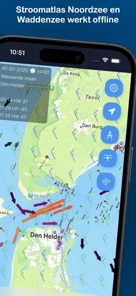
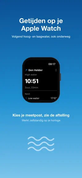
Plan your voyage smartly with up-to-date current and wind data for the North Sea, the Dutch Wadden Sea and now the entire French coast. Easily view tidal currents by location, date, and time – including direction and speed. Covers the Netherlands AND the whole of France: • Netherlands – North Sea, Wadden Sea, and the Zeeland/Scheldt delta. • France – one continuous coastline from the Belgian/Dutc…
Trends & analysis
Chart rank trend
US · overallWhy it's surfacing
Scout 14Ratings & velocity
★ 0 in windowGeographic reach
best rank · 1 storefrontRevenue & downloads trend
monthly estimateIn-app purchases
1 tiersUpdate history
2 updates tracked- v1.14.010d ago
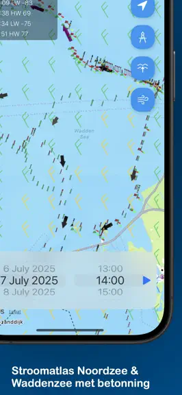
New in 1.14.0: tidal currents for the entire French coast — one continuous coastline from the Belgian/Dutch border to the Spanish border. Free and fully offline. • Strait of Dover / Pas-de-Calais — Calais, Dunkerque and Boulogne, joining straight on to the Dutch coast • English Channel (La Manche) & Normandy — the Baie de Seine (Le Havre), the Cotentin and the famous Raz Blanchard / Alderney Race off Cap de la Hague near Cherbourg • Channel Islands & the Golfe Normand-Breton — Saint-Malo, Jersey, Guernsey, Paimpol and North Brittany (Roscoff) • Atlantic coast / Bay of Biscay — West Brittany (mer d'Iroise, Ouessant, Raz de Sein, rade de Brest), South Brittany, the Pertuis Charentais (La Rochelle, Île de Ré, Oléron), the Gironde estuary and the Loire • Data from SHOM, the French hydrographic office • The Netherlands stays fully covered: North Sea, Wadden Sea and the Zeeland/Scheldt delta • The Apple Watch app, tide widget and departure & tide alerts (Stroomatlas Pro) remain available
- v1.13.013d ago
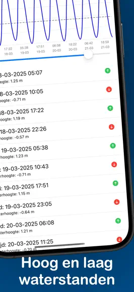
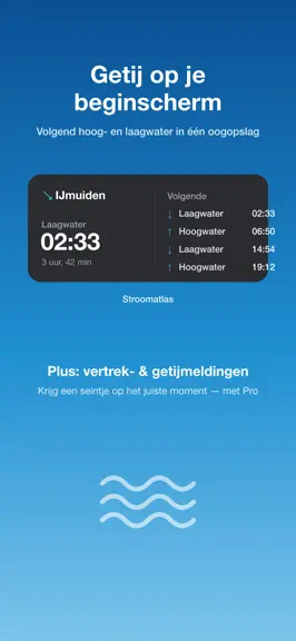
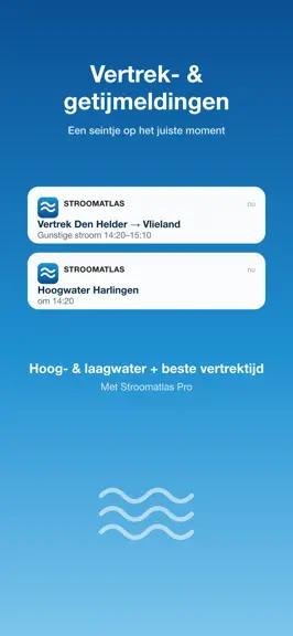
New in this version: • Departure & tide alerts — get notified automatically for high/low water and the best time to leave (Stroomatlas Pro). • Home-screen tide widget — next high & low water at a glance (free). Plus: tide data for many more departure harbors and small improvements.
Stroomatlas (Interactief) — FAQ
How many downloads does Stroomatlas (Interactief) get?
Stroomatlas (Interactief) sees an estimated 0 downloads per month on the App Store, per AppCurrents modeling.
Is Stroomatlas (Interactief) free?
Stroomatlas (Interactief) is a paid app priced at $2.99 on the App Store.
When was Stroomatlas (Interactief) released?
Stroomatlas (Interactief) launched on the App Store on 19.03.2025. Its latest version shipped 07.06.2026.