
SeaVectors: Marine Navigation
SeaVectors: Marine Navigation generates an estimated $0/month in revenue from 0 downloads/month on the App Store, according to AppCurrents estimates (updated 2026-08-02).
| Est. revenue / month | $0 |
|---|---|
| Est. downloads / month | 0 |
| Estimate confidence | low |
| Pricing | Free + IAP |
| Rating | 0.00 ★ (0 ratings) |
| Category | Navigation |
| Released | 25.06.2025 |
| App last updated | 22.07.2026 |
| Platform | iOS |
Modeled monthly estimate · rating velocity · low confidence
About
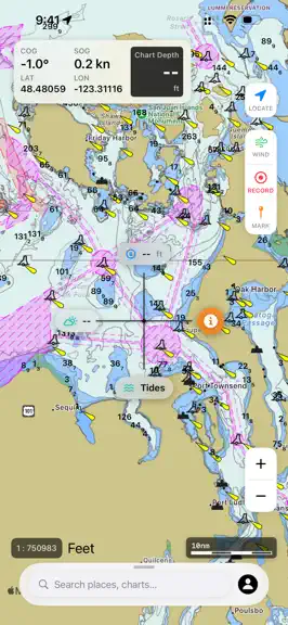
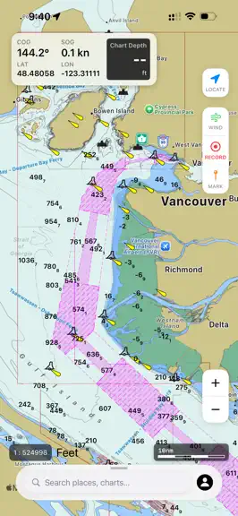
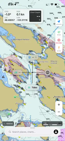
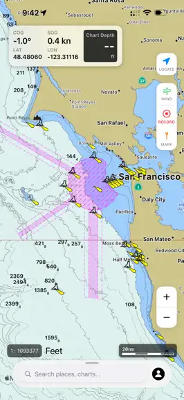
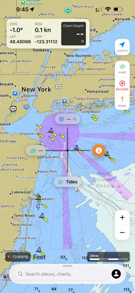
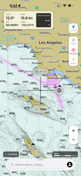
SeaVectors – Professional Marine Navigation with ECDIS-Grade ENC Charts SeaVectors combines authoritative electronic charts, connected vessel instruments, AIS collision awareness, government tide and current predictions, route planning, and 14-day offline marine forecasts in one mobile navigation workspace. - Professional ENC Charts Navigate with official NOAA ENC coverage for the United States…
Trends & analysis
Chart rank trend
US · overallWhy it's surfacing
Scout 7Ratings & velocity
★ 0 in windowGeographic reach
best rank · 1 storefrontRevenue & downloads trend
monthly estimateIn-app purchases
2 tiersUpdate history
4 updates tracked- v2.4.512d ago
This release delivers major improvements for safer, more reliable voyage planning: - Authoritative CHS and NOAA tide and current station data is now integrated directly into the chart. Review current speed and direction, tide height, slack-water periods, turning times, and upcoming events—especially valuable around harbours, channels, narrows, and tidal passages. - New 14-day offline marine forecasts let you download rain, wind, waves, tides, and currents for the visible map area before departure. Forecasts remain available when cellular or satellite connectivity is limited or unavailable offshore. - New marine search for locations, marinas, anchorages, fishing spots, routes, markers, and tide and current stations—with saved search history and recently viewed results. - New multi-leg distance measurement with leg distances, course information, route details, and one-tap conversion to a saved route. - Simplified map controls for location, follow, and course-up 3D modes. - Improved current visualization, station markers, forecast loading, map performance, and overall reliability.
- v2.021mo ago
- New: choose True or Magnetic north reference in Settings — reflected in the COG instrument widget and the floating status box. - Your chosen north reference is applied consistently everywhere: while sailing, recording tracks, replaying tracks, and running route simulations. - Automatically falls back to True North when the local magnetic declination is unavailable.
- v2.01mo ago
SeaVectors 2.0 — rebuilt from the ground up. Version 2.0 introduces an entirely new vector chart engine: faster, smoother, and sharper at every zoom level. It marks the most significant release in SeaVectors' history. To celebrate, everyone gets a fresh 30-day free trial — new and returning users alike. The new chart engine is something we're truly proud of, and we want every mariner to experience it. Update, open the app, and your 30 days start fresh. And even after the trial, you can keep using SeaVectors free for 60 minutes every day. What's new in 2.0 • Professional-grade chart engine — high-performance NOAA ENC vector charts rendered to the official S-57 standard with S-52 chart symbology, delivering an ECDIS-grade chart experience on mobile. Includes night and satellite styles and fully configurable layers. • Advanced instrument panel — a customizable dashboard for SOG, COG with compass, charted depth, position, route ETA, and cross-track error, plus live wind, current, and wave data from the marine forecast. NMEA 2000–ready gauges for speed through water (STW), engine RPM, battery, fuel, and gyro heading activate the moment an onboard source is connected. Precision dials, smooth live updates, and a drag-and-drop, resizable layout. • Route planning & simulation — build and edit multi-leg routes directly on the chart, with live total distance, estimated time of arrival, and fuel estimates calculated at your speed. Save, reverse, and manage routes for any voyage, then validate any plan with built-in simulation that drives your vessel and instruments along the track before departure. • Advanced weather overlays — live, animated marine weather rendered directly on the chart: wind and gusts, wave height, currents with speed and set, precipitation, and air temperature. Forecasts are read at your exact position and feed the instrument panel, sourced from authoritative government providers including NOAA and Environment Canada, with automatic commercial-data fallback for continuous, gap-free coverage worldwide. • Intelligent alerts — real-time notifications when your vessel enters a charted Restricted Area or a DFO fishing closure — including rockfish conservation areas, reef closures, and marine refuges — each with detailed, tap-through information. • Tides & offline access — redesigned 30-day tide forecasts and automatic offline chart caching as you navigate. • My Data hub — one home for your tracks, markers, and routes. Recorded tracks capture distance, duration, and point count, with color-coding and on-map replay to retrace any voyage. Drop markers for fishing spots, hazards, or anchorages and enrich them with labels, notes, photos, and video. Everything is organized in a clean, unified interface and stored in fast on-device storage. • Detailed light portrayal — charted navigation lights rendered with their colored sectors, nominal ranges, and leading beams, faithfully following S-52 conventions for clear identification by day or night. • Redesigned experience — a refreshed, modern interface built for the helm: a cleaner layout, an intuitive navigation bar, refined typography and controls, and a new app icon. Optimized for phone and tablet in portrait and landscape, with smoother performance throughout. • Simplified Chinese — full localization. • More reliable — a fresh 30-day trial for every user, plus improved subscription and trial handling and stability and performance enhancements across the app. Thank you for choosing SeaVectors. Fair winds and safe passage.
- v1.312mo ago
- Re-designed the Advanced Tide View, More Intuitive, Easier to Understand.
SeaVectors: Marine Navigation — FAQ
How many downloads does SeaVectors: Marine Navigation get?
SeaVectors: Marine Navigation sees an estimated 0 downloads per month on the App Store, per AppCurrents modeling.
Is SeaVectors: Marine Navigation free?
SeaVectors: Marine Navigation is free to download on the App Store, monetizing through in-app purchases.
When was SeaVectors: Marine Navigation released?
SeaVectors: Marine Navigation launched on the App Store on 25.06.2025. Its latest version shipped 22.07.2026.


