
NavimetriX
NavimetriX generates an estimated $100–$1k/month in revenue from 3–20 downloads/month on the App Store, according to AppCurrents estimates (updated 2026-08-02).
| Est. revenue / month | $100–$1k |
|---|---|
| Est. downloads / month | 3–20 |
| Estimate confidence | low |
| Pricing | Free + IAP |
| Rating | 5.00 ★ (1 ratings) |
| Category | Weather |
| Released | 21.10.2025 |
| App last updated | 29.07.2026 |
| Platform | iOS |
Modeled monthly estimate · rating velocity · low confidence

About
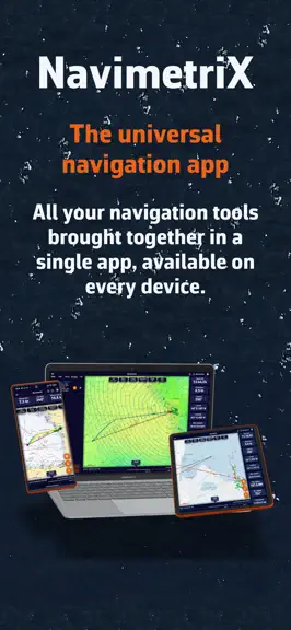
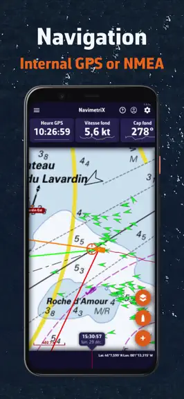
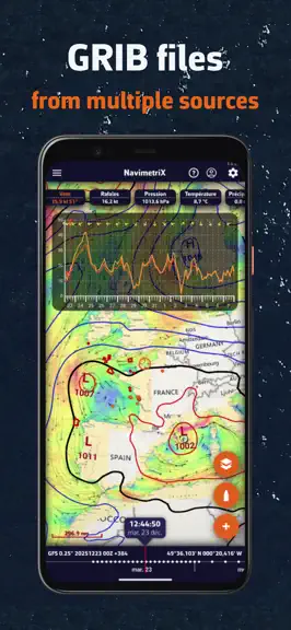
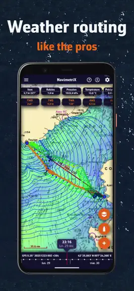
Whether you are a recreational boater, an offshore racer, or a long-distance cruiser, NavimetriX brings you everything you need, everywhere: • Multi-platform & cloud sync: Plan your routes at home on your computer or tablet and instantly retrieve all your settings, weather files, and routes onboard. Your navigation data is automatically synchronized and secured in the cloud. • Weather, waves, a…
Trends & analysis
Chart rank trend
US · overallWhy it's surfacing
Scout 15Ratings & velocity
★ 0 in windowRating distribution
100% positive · 1 ratingsGeographic reach
best rank · 4 storefrontsRevenue & downloads trend
ARPU $61In-app purchases
1 tiersUpdate history
6 updates tracked- v1.226d ago
This update fixes the display on iPhones with a notch or Dynamic Island: the area-selection and route/zone editing banners now sit below them and stay fully legible. Fair winds!
- v1.217d ago
A redesigned interface, next-generation instruments and AIS weather. • Redesigned interface — Full-bleed edge-to-edge chart: the chrome floats on top and gets out of the way. New edge-handle drawers, unified typography and design, and a marine red night mode that preserves your night vision. • Next-generation instruments — A single bar you reorder by drag-and-drop, several instances per type and 14 gauge types: chart, rudder angle, GNSS satellites, energy and batteries, polar, analog wind dial, enriched course compass. Per-instrument settings with live preview, resizable dock, layout remembered per orientation. • AIS weather stations — Weather stations and boats in cyan, visible at every zoom level and selectable even zoomed out, with observation decoding and real-size hull silhouettes. • Timeline — Vertical column in landscape on phones, with a collapse animation. • GRIB — Models download automatically as soon as a new run is available. • Measure and routing — Add a measure or an instrument with a long press, a new "double bearing" style, and start a routing straight from a route's context menu. • Remote cockpit (Premium) — Follow another boat's live NMEA and AIS over the network. • Comfort and smoothness — Energy-saving mode, instruments frozen during chart gestures, and true full screen on tablets. • Plus many stability and polish improvements. Fair winds!
- v1.2027d ago
Anchor watch, much faster routing, and many refinements. • Anchor watch — Set your anchor zone (circle or hexagon) and an alarm warns you if the boat drags. Premium option: remote SMS alert with bearing, distance and a Google Maps link. • Faster routing — Route calculation is now much faster, including ensemble routings. • Routing details — Waves and precipitation along the optimal route, a new 4-tab details window, and an AI briefing. • Suggested models — The magic wand automatically recommends the right wind, current and wave models for your sailing area. • Bearings — Show bearings as true or magnetic (°T/°M), plus more reliable NMEA autopilot commands. • Better tracks — Moving time and sustained top speed, complete live track, automatic database repair. • Chart & navigation — Buttery-smooth panning, lower battery consumption, and a GPS-loss alarm that holds the last known position. • Plus many stability and polish improvements. Fair winds!
- v1.181mo ago
Smoother charts, longer battery life, and safer navigation. • Buttery-smooth chart — Panning and zooming stay fluid even with tide stations and lightning displayed. • Longer battery life — Lower battery consumption for longer battery life. • Safer underway — If your GPS signal drops, your boat holds its last known position and a new GPS-loss alarm warns you, instead of jumping to a wrong location. Navigation Mode also no longer turns on by itself. • Better tracks — The track you just recorded now stays on the chart, and your live track shows your whole trip at a glance. • AIS & instruments — Clearer collision-alarm readouts, refreshed NMEA device presets, and simpler NMEA log export. • Plus many stability and polish improvements. Fair winds!
- v1.171mo ago
Version 1.17 is a major update: a modernised graphics engine, much faster charts, new routing and track tools, and dozens of fixes and optimisations. PERFORMANCE & SMOOTHNESS • Modernised rendering engine: far smoother map panning, zooming and inertia, all the way to the deepest zoom. • Reworked AIS display: many more targets handled smoothly. • Smoother rain radar and lightning (optimised rendering, off-thread processing). • Lower battery use while navigating. FASTER CHARTS, AVAILABLE OFFLINE • Marine charts (SHOM / Geogarage) are far more responsive when zooming and panning: areas you've already viewed reappear instantly. • Charts now work on board on a Wi-Fi network with no real Internet access, and refresh automatically as soon as the connection returns. • No more app restart needed for offline Geogarage charts. ROUTING • New route editor: create and edit routes from POIs, with a dedicated per-route menu. • Convert a weather routing into an editable, simplified route. • Departure time remembered (up to 36 h), more accurate engine hours, boat speed up to 30 knots, and clearer GRIB-coverage messages. TRACKS • New Tracks tab: per-session management, GPX import/export, export by date range, and Strava upload. • Recolour saved tracks, show the full track while navigating, and "Erase track" is now complete and permanent. AIS, STATIONS & ZONES • AIS: distance and bearing while navigating, AtoN types, and the ability to select a target even when it overlaps a zone. • In-situ observation stations: names shown directly on the chart and an info panel that opens reliably on tap. • No-go zones: smooth map panning even with a zone displayed, and fixed point editing. CONNECTIVITY (NMEA / GPS) • Master NMEA switch with per-direction memory. • Dimmed-screen mode keeps the NMEA feed alive. INTERFACE & STABILITY • Larger, better-placed on-screen zoom buttons for touch use. • Many stability fixes and polish. Fair winds and safe sailing!
NavimetriX — FAQ
How much money does NavimetriX make?
According to AppCurrents estimates, NavimetriX generates approximately $100–$1k per month (low confidence), modeled from its the App Store chart performance, rating velocity, and monetization signals.
How many downloads does NavimetriX get?
NavimetriX sees an estimated 3–20 downloads per month on the App Store, per AppCurrents modeling.
Is NavimetriX free?
NavimetriX is free to download on the App Store, monetizing through in-app purchases.
What is NavimetriX's rating?
NavimetriX holds a 5.00-star average from 1 ratings on the App Store.
When was NavimetriX released?
NavimetriX launched on the App Store on 21.10.2025. Its latest version shipped 29.07.2026.


