
Merestone: SSSI & Habitat Map
Merestone: SSSI & Habitat Map generates an estimated $0/month in revenue from 0 downloads/month on the App Store, according to AppCurrents estimates (updated 2026-10-03).
| Est. revenue / month | $0 |
|---|---|
| Est. downloads / month | 0 |
| Estimate confidence | low |
| Pricing | Free + IAP |
| Rating | 0.00 ★ (0 ratings) |
| Category | Reference |
| Released | 01.09.2026 |
| App last updated | 28.09.2026 |
| Platform | iOS |
Modeled monthly estimate · rating velocity · low confidence


About
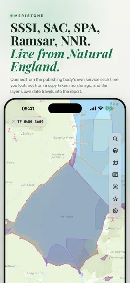
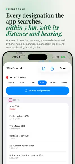
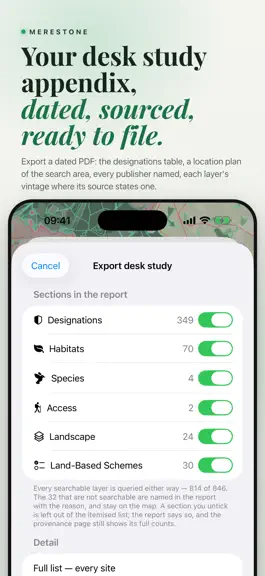
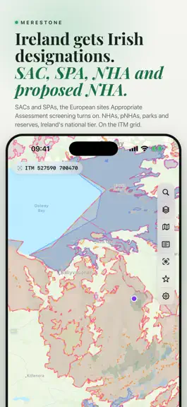
Merestone runs the designated sites search of a desk study and writes the appendix. Drop a pin, set a radius: SSSI, SAC, SPA, Ramsar, ancient woodland and priority habitat in the UK, SAC, SPA, NHA and pNHA in Ireland, by distance, in a dated PDF. Not a survey, not a LERC search. Fifteen countries, 1,400+ layers, 100+ free. ON THE MAP, UK • SSSI in England, Scotland and Wales, with unit condition…
Trends & analysis
Chart rank trend
US · overallWhy it's surfacing
Scout 29Ratings & velocity
★ 0 in windowGeographic reach
best rank · 0 storefrontsRevenue & downloads trend
monthly estimateIn-app purchases
10 tiersUpdate history
2 updates tracked- v2.6.04d ago
Poland joins Merestone, and the app now speaks Polish and Finnish. POLAND, 77 LAYERS Free: Natura 2000 special areas of conservation (SOO) and special protection areas for birds (OSO). Pro adds national parks and nature reserves with their buffer zones, landscape parks and protected landscape areas, natural monuments, ecological sites and corridors, Ramsar sites, Natura 2000 habitats from the Forest Data Bank (BDL), Seveso establishments, wind turbines, the Wody Polskie flood hazard and risk maps for the 10, 100 and 500 year floods, SOPO landslides, groundwater reservoirs, mineral deposits and mining areas, geosites, the plan ogólny zones where a gmina has adopted one, local plan outlines, the registers of monuments, State Forests compartments and protective forests, parcels and the maritime spatial plans. The flood, landslide, plan ogólny, monument and parcel layers are the publishers' map images: they draw and answer a tap, but stay out of the radius search, the PDF and downloads. With Pro, search finds a parcel by its identifier or by place and number. No species records. Grid: PL-1992, with PL-2000 in the desk study. FINNISH The app and its desk study PDF can now be in Finnish. Finland itself is not covered yet. 126 NEW LAYERS ELSEWHERE • UK: Scottish flood maps with climate change, felling permissions and Nature Conservation Orders; England's coastal erosion projections to 2105, shoreline management plans, historic parklands and building preservation notices • Ireland: the Residential Zoned Land Tax map and hen harrier habitat • Portugal: mainland PDM zoning (CRUS), the Azores, and Madeira, whose regional government layers are free • Germany: national flood areas, drinking water protection zones and nature parks; protected biotopes in Brandenburg, Hamburg, Saarland and Thuringia, Bavaria's Ökoflächenkataster, and state layers for Baden-Württemberg, Mecklenburg-Vorpommern and Rhineland-Palatinate • Switzerland: land parcels where the canton allows it, live only • Belgium: Walloon mine shafts, underground quarries, rockfall and Seveso zones; Flemish protected dunes; the Brussels soil inventory • Spain: geological heritage sites, ground movements, nitrate vulnerable zones • Norway: radon, marine clay, storm surge in 2100, wilderness areas (INON), aquaculture sites, spawning and nursery areas, national salmon fjords • Sweden: the Natura habitat map, meadows and pastures (TUVA), potentially contaminated sites, coastal erosion, the national interest for wind power, trails in protected areas • Italy: vincolo idrogeologico in Lombardy, Sardinia, Veneto and South Tyrol • Netherlands: river reservations for the Maas and the Rhine branches • Luxembourg: nature trails. France: PPR perimeters, now one layer per hazard FIXES Wording corrected throughout the nine earlier translations, and the desk study uses each language's own plural forms. Areas that Baden-Württemberg and Saxony publish in square metres are no longer labelled as hectares. Walloon water bodies answer again, and Norwegian heritage and the French cavity and ground-movement layers now come from their publishers' new services. The bundles are now named DE+AT+CH and Benelux, for the countries they already included, and the free trial is never called a gift. Luxembourg's PAG zoning layers are shown but locked until the publisher confirms their licence.
- v2.3.018d ago
Germany and Switzerland arrive, and the app is now in German and Italian. • Germany: 64 layers, the nationwide ones from the European Environment Agency and more from eight Länder, in UTM. • Switzerland: 71 layers, most from the federal offices and the cantons, in LV95. • Germany and Switzerland can be bought on their own or together. • The app and the PDF in German and Italian, with Swiss spelling for German readers in Switzerland. • An optional Merestone account: sign in with your email to link your App Store purchases to merestonemaps.com. You can delete it in Settings. • The default search radius no longer shows blank after moving between countries.
Merestone: SSSI & Habitat Map — FAQ
How many downloads does Merestone: SSSI & Habitat Map get?
Merestone: SSSI & Habitat Map sees an estimated 0 downloads per month on the App Store, per AppCurrents modeling.
Is Merestone: SSSI & Habitat Map free?
Merestone: SSSI & Habitat Map is free to download on the App Store, monetizing through in-app purchases.
When was Merestone: SSSI & Habitat Map released?
Merestone: SSSI & Habitat Map launched on the App Store on 01.09.2026. Its latest version shipped 28.09.2026.
Apps like Merestone: SSSI & Habitat Map
See all alternatives → Translate Now - AI TranslatorReference · $420k–$2.7M/mo
 Ancestry: Family History & DNAReference · $420k–$2.7M/mo
 Bible Chat: Daily DevotionalReference · $420k–$2.7M/mo
 CoinIn: Coin Scan IdentifierReference · $280k–$1.8M/mo
 Quran Majeed – القران الكريمReference · $230k–$1.3M/mo
 Hallow: Prayer & MeditationReference · $200k–$1.4M/mo