Mediterranean Sea GPS Charts
Mediterranean Sea GPS Charts generates an estimated $0/month in revenue from 0 downloads/month on the App Store, according to AppCurrents estimates (updated 2026-06-17).
| Est. revenue / month | $0 |
|---|---|
| Est. downloads / month | 0 |
| Estimate confidence | low |
| Pricing | Paid $12.99 |
| Rating | 0.00 ★ (0 ratings) |
| Category | Navigation |
| Released | 10.01.2011 |
| App last updated | 13.10.2023 |
| Platform | iOS |
Modeled monthly estimate · rating velocity · low confidence
About
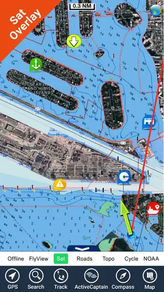
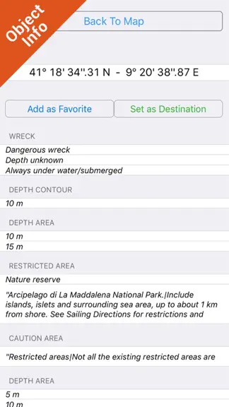
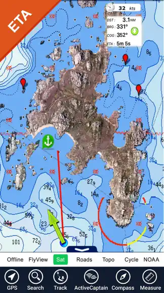
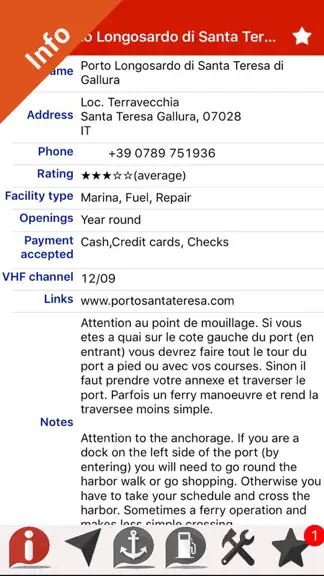
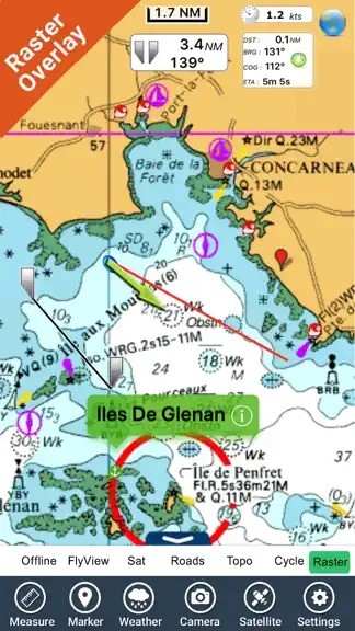
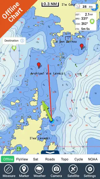
Flytomap is a valid and interesting alternative, Benetti Yachts Featured in : On the Deck Mediterranean Sea - The whole coverage resident in the app. It works WITHOUT mobile coverage! • Worldwide Marine and Outdoor Maps available, thanks to viewer.flytomap.com • Worldwide Satellite images overlay on charts • Worldwide Terrain features overlay on charts, thanks to Open Street Map, Open Cycle Map…
Trends & analysis
Chart rank trend
US · overallWhy it's surfacing
Scout 11Ratings & velocity
★ 0 in windowGeographic reach
best rank · 1 storefrontRevenue & downloads trend
monthly estimateIn-app purchases
1 tiersUpdate history
1 update tracked- v5.7.32.7y ago
Updated for latest devices.
Mediterranean Sea GPS Charts — FAQ
How many downloads does Mediterranean Sea GPS Charts get?
Mediterranean Sea GPS Charts sees an estimated 0 downloads per month on the App Store, per AppCurrents modeling.
Is Mediterranean Sea GPS Charts free?
Mediterranean Sea GPS Charts is a paid app priced at $12.99 on the App Store.
When was Mediterranean Sea GPS Charts released?
Mediterranean Sea GPS Charts launched on the App Store on 10.01.2011. Its latest version shipped 13.10.2023.