
LakeMap – Swiss Lake Charts
LakeMap – Swiss Lake Charts generates an estimated $0/month in revenue from 0 downloads/month on the App Store, according to AppCurrents estimates (updated 2026-10-02).
| Est. revenue / month | $0 |
|---|---|
| Est. downloads / month | 0 |
| Estimate confidence | low |
| Pricing | Free |
| Rating | 0.00 ★ (0 ratings) |
| Category | Navigation |
| Released | 26.08.2026 |
| App last updated | 05.09.2026 |
| Platform | iOS |
Modeled monthly estimate · rating velocity · low confidence
About
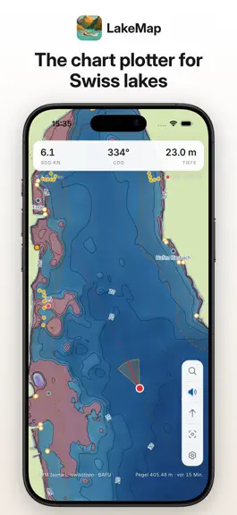
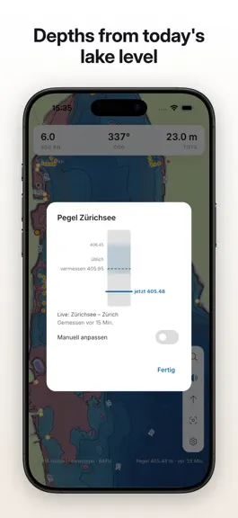
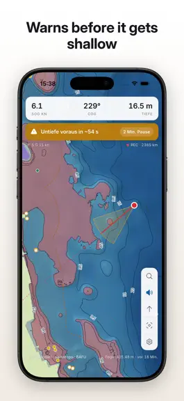
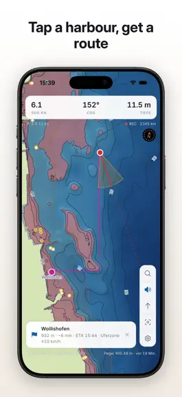
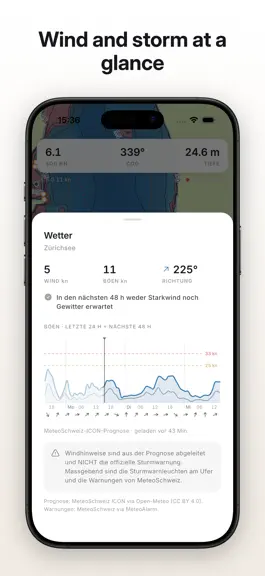
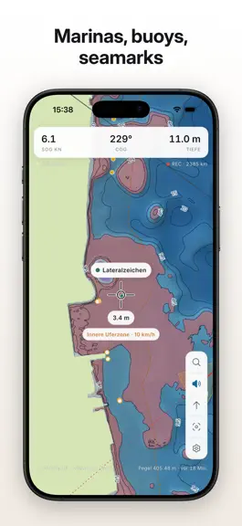
LakeMap is the offline chart plotter for Swiss lakes: 22 surveyed lakes with official bathymetry (swisstopo swissBATHY3D) ship inside the app — depth contours, depth shading, seamarks and marinas all work with no connection at all. THE DIFFERENCE: DEPTHS FROM THE LIVE LAKE LEVEL Ordinary charts show depths against a fixed datum. LakeMap computes with the current water level (Swiss federal gauges,…
Trends & analysis
Chart rank trend
US · overallWhy it's surfacing
Scout 29Ratings & velocity
★ 0 in windowGeographic reach
best rank · 0 storefrontsRevenue & downloads trend
monthly estimateUpdate history
2 updates tracked- v1.0.926d ago
• 11 new lakes: Greifensee, Pfäffikersee, Lake Lugano, Lago di Poschiavo, Lauerzersee and the reservoirs Sihlsee, Lac de la Gruyère, Schiffenensee, Wägitalersee, Wohlensee and Klöntalersee. Their floors come from national-map depth contours (no sonar survey), so they are marked as orientation charts; reservoirs also flag their swinging level, which you set manually. • Lake Lugano gets its live level from the BAFU gauge at Melide. • Perspective view: the compass button now cycles north-up → course-up → tilted 3D view. • Search covers every lake: harbours and services from all installed charts, each with its distance from the boat or the map centre. • Faster first position: the boat shows immediately from the first coarse fix and sharpens as GPS settles. • Smarter opening view: the chart opens on your last position, or on Lake Zurich when you are far from the lakes. • Level and wind chips stay visible within 5 km of a lake, so conditions can be checked from the harbour or the road; between two lakes the nearer shore decides. • Refreshed depth contours for all lakes.
- v1.0.71mo ago
• Restricted areas: speed limits, bathing areas, nature reserves and no-entry zones show as rule chips at the cursor. • Harbour layouts: piers, breakwaters and slipways from OpenStreetMap, so a harbour reads on approach. • Live lake levels now come straight from the BAFU open-data platform (data.bafu.admin.ch), with a fallback feed if it is unavailable. • Shore zones are now part of the chart tiles: sharper and instantly available. • Refreshed charts for Zürichsee, Zugersee, Walensee and Vierwaldstättersee. • Much faster start-up: chart packs are no longer re-copied on every launch and loading runs off the main thread. • Smoother map: level, safety depth and layer changes apply in place without reloading the chart. • Lower battery and memory use: refreshes pause while the app is off screen (unless watch mode is on), depth data loads on demand.
LakeMap – Swiss Lake Charts — FAQ
How many downloads does LakeMap – Swiss Lake Charts get?
LakeMap – Swiss Lake Charts sees an estimated 0 downloads per month on the App Store, per AppCurrents modeling.
Is LakeMap – Swiss Lake Charts free?
LakeMap – Swiss Lake Charts is free to download on the App Store, with no in-app purchases detected.
When was LakeMap – Swiss Lake Charts released?
LakeMap – Swiss Lake Charts launched on the App Store on 26.08.2026. Its latest version shipped 05.09.2026.
Apps like LakeMap – Swiss Lake Charts
See all alternatives → Google MapsNavigation · $760k–$4.1M/mo
 Transit • Subway & Bus TimesNavigation · $690k–$3.8M/mo
 onX Hunt: GPS Hunting MapsNavigation · $350k–$1.2M/mo
 Speedometer SimpleNavigation · $48k–$260k/mo
 Trucker Path: Truck GPS & FuelNavigation · $48k–$260k/mo
 Find my Phone - Family LocatorNavigation · $37k–$210k/mo