
ForeFlight Mobile EFB
ForeFlight Mobile EFB generates an estimated $17k–$110k/month in revenue from 18k–74k downloads/month on the App Store, according to AppCurrents estimates (updated 2026-09-08).
| Est. revenue / month | $17k–$110k |
|---|---|
| Est. downloads / month | 18k–74k |
| Estimate confidence | low |
| Pricing | Free + IAP |
| Rating | 4.41 ★ (3,247 ratings) |
| Category | Weather |
| Best chart rank | #17 Weather Grossing |
| Released | 16.12.2009 |
| App last updated | 01.09.2026 |
| Platform | iOS |
Modeled monthly estimate · rating velocity · low confidence
About
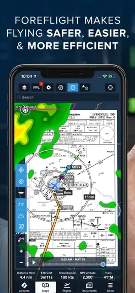
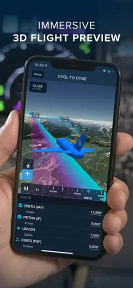
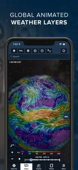
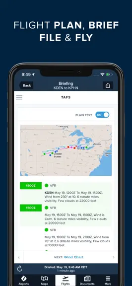
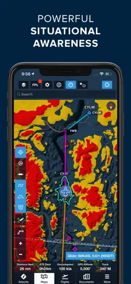
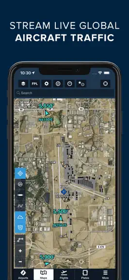
Download for a 30-day free trial of our top subscription plan! Visit our website for more information on available plans and add-ons. ForeFlight is the leading flight app for VFR and IFR pilots everywhere, making flight planning and flying easier, safer, and more enjoyable. FLIGHT PLANNING, BRIEFING, & FILING Plan flights with Touch Planning on the Map or full-featured form-based Flights view. T…
Trends & analysis
Chart rank trend
US · categoryWhy it's surfacing
Scout 30Ratings & velocity
★ 0 in windowRating distribution
84% positive · 3k ratingsGeographic reach
best rank · 12 storefrontsRevenue & downloads trend
ARPU $1In-app purchases
9 tiersUpdate history
9 updates tracked- v18.7.2today
ForeFlight Debrief • Review, analyze, and learn from every flight with automatic Track Log segmentation and scoring, now available on both mobile and web. • Debrief is disabled by default but can be enabled in More > Account > ForeFlight Labs. • Visit More > Track Logs to review recorded flights using either the existing graph-and-map view, or tap the magnifying glass button in the lower-right corner of the map to enter the new Debrief view. • Debrief automatically segments flights into multiple phases such as takeoff, airborne segments, approach, and landing, allowing you to jump to any segment by tapping on it. • Debrief also analyzes certain maneuvers and procedures it identifies using recorded flight data, comparing this data to published Airmen Certificate Standards and assigning each segment a score out of 100 to help you identify training opportunities. • The 3D Review feature built into the Track Logs view is also now integrated with both the Track Log graph and the Debrief view, allowing you to review your flight using either the default overhead map view or first- or third-person 3D view in the same interface. • Available with Essential subscription plans and above. ForeFlight Insurance Tab • Affordable aviation insurance for aircraft owners, renters, and CFIs is now just a tap away in ForeFlight. • Visit More > Insurance to apply for owned or non-owned insurance quotes with a streamlined digital workflow that allows you to automatically populate your flight experience using your logged flights, invite co-owners to provide their pilot experience via email, and more. • Most quotes are returned and ready to review, sign, and purchase in minutes, with helpful comparisons, explanations of insurance terminology, and highlighted policy benefits to help you pick the best policy for how you fly. • After purchasing, view policy documents and save them to ForeFlight’s Documents tab for easy access whenever you need them. • Insurance is sold through ForeFlight Insurance Agency, LLC, which is a licensed insurance agency, not an insurance company. • Available for individual US customers in More > Insurance or on the web at foreflight.com/insurance. MFB: ForeFlight TAK • ForeFlight Mobile now connects to TAK servers, streaming your position to the network while bringing other TAK-connected assets onto your map as live traffic. • Servers can be added in More > Devices > TAK by entering address, port, and credentials in TAK Settings, or automatically by importing a TAK connection package (.zip) via AirDrop, email, or file share — which adds a read-only connection that begins syncing immediately. • In TAK Settings, configure your callsign, team, role, and display type, and set color priority by team assignment or affiliation, control per-server send/receive toggles, and more. • After enabling the TAK map layer from the Layer Selector, the map displays a TAK server count label in the top-left alongside any ADS-B or device traffic status, with no label shown when no servers are connected. • Available with ForeFlight MFB One subscription plans. MFB: Dynamic Corridor Panel • Leave static doghouses behind with a responsive information panel providing key details about the current leg including heading, distance, ETE, clearance altitudes, and more. • With Low Level Corridors created, tap the Dynamic Corridor Panel display button located underneath the tool bar in the top right corner of the screen to display the panel. • Tap the three dots to open the panel menu and adjust its position on the screen. The panel will automatically display information for your current leg, and you can swipe or use the arrows at the bottom to move to another leg. • Your leg end point, heading, estimated time enroute, and leg distance will display by default. Tap “edit panel” to choose from ten different widgets to display. • Available with ForeFlight MFB One subscription plans.
- v18.7.17d ago
ForeFlight Debrief • Review, analyze, and learn from every flight with automatic Track Log segmentation and scoring, now available on both mobile and web. • Debrief is disabled by default but can be enabled in More > Account > ForeFlight Labs. • Visit More > Track Logs to review recorded flights using either the existing graph-and-map view, or tap the magnifying glass button in the lower-right corner of the map to enter the new Debrief view. • Debrief automatically segments flights into multiple phases such as takeoff, airborne segments, approach, and landing, allowing you to jump to any segment by tapping on it. • Debrief also analyzes certain maneuvers and procedures it identifies using recorded flight data, comparing this data to published Airmen Certificate Standards and assigning each segment a score out of 100 to help you identify training opportunities. • The 3D Review feature built into the Track Logs view is also now integrated with both the Track Log graph and the Debrief view, allowing you to review your flight using either the default overhead map view or first- or third-person 3D view in the same interface. • Available with Essential subscription plans and above. ForeFlight Insurance Tab • Affordable aviation insurance for aircraft owners, renters, and CFIs is now just a tap away in ForeFlight. • Visit More > Insurance to apply for owned or non-owned insurance quotes with a streamlined digital workflow that allows you to automatically populate your flight experience using your logged flights, invite co-owners to provide their pilot experience via email, and more. • Most quotes are returned and ready to review, sign, and purchase in minutes, with helpful comparisons, explanations of insurance terminology, and highlighted policy benefits to help you pick the best policy for how you fly. • After purchasing, view policy documents and save them to ForeFlight’s Documents tab for easy access whenever you need them. • Insurance is sold through ForeFlight Insurance Agency, LLC, which is a licensed insurance agency, not an insurance company. • Available for individual US customers in More > Insurance or on the web at foreflight.com/insurance. MFB: ForeFlight TAK • ForeFlight Mobile now connects to TAK servers, streaming your position to the network while bringing other TAK-connected assets onto your map as live traffic. • Servers can be added in More > Devices > TAK by entering address, port, and credentials in TAK Settings, or automatically by importing a TAK connection package (.zip) via AirDrop, email, or file share — which adds a read-only connection that begins syncing immediately. • In TAK Settings, configure your callsign, team, role, and display type, and set color priority by team assignment or affiliation, control per-server send/receive toggles, and more. • After enabling the TAK map layer from the Layer Selector, the map displays a TAK server count label in the top-left alongside any ADS-B or device traffic status, with no label shown when no servers are connected. • Available with ForeFlight MFB One subscription plans. MFB: Dynamic Corridor Panel • Leave static doghouses behind with a responsive information panel providing key details about the current leg including heading, distance, ETE, clearance altitudes, and more. • With Low Level Corridors created, tap the Dynamic Corridor Panel display button located underneath the tool bar in the top right corner of the screen to display the panel. • Tap the three dots to open the panel menu and adjust its position on the screen. The panel will automatically display information for your current leg, and you can swipe or use the arrows at the bottom to move to another leg. • Your leg end point, heading, estimated time enroute, and leg distance will display by default. Tap “edit panel” to choose from ten different widgets to display. • Available with ForeFlight MFB One subscription plans.
- v18.6.418d ago
ClearNOTAMs • Easily review NOTAMs before a flight with reliable AI translations that convey the essential meaning of every NOTAM in plain English, with the original text only a tap away. • Translated NOTAMs are available throughout ForeFlight Mobile and ForeFlight Web in all places you view NOTAMs, except for the PDF Briefing format. • Tap “Show Source” below any translated NOTAM to compare it side-by-side with the original text to verify the translation’s accuracy. In the rare case of an inaccurate translation, a built-in “Report Error” button allows you to seamlessly notify ForeFlight staff of the error. • ClearNOTAMs works alongside the enhanced NOTAM interface described below, making it easier to review, prioritize, and understand the information that matters most during your briefing. • ClearNOTAMs is available with all individual ForeFlight subscription plans as a limited-time preview, and will subsequently be available with Premium, Business Performance, MFB Performance, and MFB One subscription plans. NOTAM Interface Improvements • Find the NOTAMs you care about faster with new filtering, sorting, and organization tools. • You can view the new NOTAM interface improvements from the NOTAM tab in the Airports view or by tapping the airport on the map. • Filter NOTAMs by category, source, activation time, and more to narrow the list. • Sort NOTAMs by category, recency, effective time, and more, then pin important NOTAMs to the top of the view or collapse less important NOTAMs with a double-tap. • The enhanced NOTAM interface is available with all ForeFlight subscription plans. Flights: Mobile Clearance • Skip the clearance calls and get to the runway faster by requesting, reviewing, and accepting your IFR departure clearance entirely within ForeFlight at a growing number of U.S. airports. • The option to request your mobile clearance will become available 30 minutes prior to your filed departure time at the bottom of the Flights view. • ForeFlight will automatically notify you when ATC returns your clearance, including the full route string and an inset map depiction, after which you’ll have five minutes to review it and either accept or reject it. • Mobile Clearance is available for all customers initially at several airports primarily in southeast Texas, Kansas, and Wisconsin, and will be enabled at more airports by the FAA over time. ForeFlight AI Connector • Connect ForeFlight to ChatGPT to discover new ways to plan, brief, and more, all grounded in your own ForeFlight data. • Search for ForeFlight Mobile in the ChatGPT Plugin Directory to add the plugin and authenticate with your ForeFlight account. ChatGPT can then access data from your account and ForeFlight such as flight, aircraft, Logbook, and performance data, current and forecast weather, and more in response to your prompts. • Available to all individual ForeFlight subscribers as an open preview. Logbook: Progress Report Guidance • Understand progress reports more easily with clear breakdowns of each requirement, guidance on how to log qualifying time, and links to the published regs. Tap Details next to each requirement to learn more. Maps: Enhanced Airport Diagrams • Improve your situational awareness while taxiing with highly-detailed diagrams for over 1,200 airports globally depicting yellow centerlines and hold short bars, tie-down locations, gate labels, and more. Simply zoom into ForeFlight’s Aeronautical Map layer to view the enhanced diagrams. Maps: One-Finger Zoom • Easily zoom in and out of the map by double-tapping and then dragging your finger up or down, perfect for one-handed control on iPhone and an alternative to the pinch-zoom gesture on iPad.
- v18.6.229d ago
ClearNOTAMs • Easily review NOTAMs before a flight with reliable AI translations that convey the essential meaning of every NOTAM in plain English, with the original text only a tap away. • Translated NOTAMs are available throughout ForeFlight Mobile and ForeFlight Web in all places you view NOTAMs, except for the PDF Briefing format. • Tap “Show Source” below any translated NOTAM to compare it side-by-side with the original text to verify the translation’s accuracy. In the rare case of an inaccurate translation, a built-in “Report Error” button allows you to seamlessly notify ForeFlight staff of the error. • ClearNOTAMs works alongside the enhanced NOTAM interface described below, making it easier to review, prioritize, and understand the information that matters most during your briefing. • ClearNOTAMs is available with all individual ForeFlight subscription plans as a limited-time preview, and will subsequently be available with Premium, Business Performance, MFB Performance, and MFB One subscription plans. NOTAM Interface Improvements • Find the NOTAMs you care about faster with new filtering, sorting, and organization tools. • You can view the new NOTAM interface improvements from the NOTAM tab in the Airports view or by tapping the airport on the map. • Filter NOTAMs by category, source, activation time, and more to narrow the list. • Sort NOTAMs by category, recency, effective time, and more, then pin important NOTAMs to the top of the view or collapse less important NOTAMs with a double-tap. • The enhanced NOTAM interface is available with all ForeFlight subscription plans. Flights: Mobile Clearance • Skip the clearance calls and get to the runway faster by requesting, reviewing, and accepting your IFR departure clearance entirely within ForeFlight at a growing number of U.S. airports. • The option to request your mobile clearance will become available 30 minutes prior to your filed departure time at the bottom of the Flights view. • ForeFlight will automatically notify you when ATC returns your clearance, including the full route string and an inset map depiction, after which you’ll have five minutes to review it and either accept or reject it. • Mobile Clearance is available for all customers initially at several airports primarily in southeast Texas, Kansas, and Wisconsin, and will be enabled at more airports by the FAA over time. ForeFlight AI Connector • Connect ForeFlight to ChatGPT to discover new ways to plan, brief, and more, all grounded in your own ForeFlight data. • Search for ForeFlight Mobile in the ChatGPT Plugin Directory to add the plugin and authenticate with your ForeFlight account. ChatGPT can then access data from your account and ForeFlight such as flight, aircraft, Logbook, and performance data, current and forecast weather, and more in response to your prompts. • Available to all individual ForeFlight subscribers as an open preview. Logbook: Progress Report Guidance • Understand progress reports more easily with clear breakdowns of each requirement, guidance on how to log qualifying time, and links to the published regs. Tap Details next to each requirement to learn more. Maps: Enhanced Airport Diagrams • Improve your situational awareness while taxiing with highly-detailed diagrams for over 1,200 airports globally depicting yellow centerlines and hold short bars, tie-down locations, gate labels, and more. Simply zoom into ForeFlight’s Aeronautical Map layer to view the enhanced diagrams. Maps: One-Finger Zoom • Easily zoom in and out of the map by double-tapping and then dragging your finger up or down, perfect for one-handed control on iPhone and an alternative to the pinch-zoom gesture on iPad.
- v18.6.11mo ago
ClearNOTAMs • Easily review NOTAMs before a flight with reliable AI translations that convey the essential meaning of every NOTAM in plain English, with the original text only a tap away. • Translated NOTAMs are available throughout ForeFlight Mobile and ForeFlight Web in all places you view NOTAMs, except for the PDF Briefing format. • Tap “Show Source” below any translated NOTAM to compare it side-by-side with the original text to verify the translation’s accuracy. In the rare case of an inaccurate translation, a built-in “Report Error” button allows you to seamlessly notify ForeFlight staff of the error. • ClearNOTAMs works alongside the enhanced NOTAM interface described below, making it easier to review, prioritize, and understand the information that matters most during your briefing. • ClearNOTAMs is available with all individual ForeFlight subscription plans as a limited-time preview, and will subsequently be available with Premium, Business Performance, MFB Performance, and MFB One subscription plans. NOTAM Interface Improvements • Find the NOTAMs you care about faster with new filtering, sorting, and organization tools. • You can view the new NOTAM interface improvements from the NOTAM tab in the Airports view or by tapping the airport on the map. • Filter NOTAMs by category, source, activation time, and more to narrow the list. • Sort NOTAMs by category, recency, effective time, and more, then pin important NOTAMs to the top of the view or collapse less important NOTAMs with a double-tap. • The enhanced NOTAM interface is available with all ForeFlight subscription plans. Flights: Mobile Clearance • Skip the clearance calls and get to the runway faster by requesting, reviewing, and accepting your IFR departure clearance entirely within ForeFlight at a growing number of U.S. airports. • The option to request your mobile clearance will become available 30 minutes prior to your filed departure time at the bottom of the Flights view. • ForeFlight will automatically notify you when ATC returns your clearance, including the full route string and an inset map depiction, after which you’ll have five minutes to review it and either accept or reject it. • Mobile Clearance is available for all customers initially at several airports primarily in southeast Texas, Kansas, and Wisconsin, and will be enabled at more airports by the FAA over time. ForeFlight AI Connector • Connect ForeFlight to ChatGPT to discover new ways to plan, brief, and more, all grounded in your own ForeFlight data. • Search for ForeFlight Mobile in the ChatGPT Plugin Directory to add the plugin and authenticate with your ForeFlight account. ChatGPT can then access data from your account and ForeFlight such as flight, aircraft, Logbook, and performance data, current and forecast weather, and more in response to your prompts. • Available to all individual ForeFlight subscribers as an open preview. Logbook: Progress Report Guidance • Understand progress reports more easily with clear breakdowns of each requirement, guidance on how to log qualifying time, and links to the published regs. Tap Details next to each requirement to learn more. Maps: Enhanced Airport Diagrams • Improve your situational awareness while taxiing with highly-detailed diagrams for over 1,200 airports globally depicting yellow centerlines and hold short bars, tie-down locations, gate labels, and more. Simply zoom into ForeFlight’s Aeronautical Map layer to view the enhanced diagrams. Maps: One-Finger Zoom • Easily zoom in and out of the map by double-tapping and then dragging your finger up or down, perfect for one-handed control on iPhone and an alternative to the pinch-zoom gesture on iPad.
ForeFlight Mobile EFB — FAQ
How much money does ForeFlight Mobile EFB make?
According to AppCurrents estimates, ForeFlight Mobile EFB generates approximately $17k–$110k per month (low confidence), modeled from its the App Store chart performance, rating velocity, and monetization signals.
How many downloads does ForeFlight Mobile EFB get?
ForeFlight Mobile EFB sees an estimated 18k–74k downloads per month on the App Store, per AppCurrents modeling.
Is ForeFlight Mobile EFB free?
ForeFlight Mobile EFB is free to download on the App Store, monetizing through in-app purchases.
What is ForeFlight Mobile EFB's rating?
ForeFlight Mobile EFB holds a 4.41-star average from 3,247 ratings on the App Store. It currently ranks #17 on the Weather grossing chart.
When was ForeFlight Mobile EFB released?
ForeFlight Mobile EFB launched on the App Store on 16.12.2009. Its latest version shipped 01.09.2026.


