
Anchor Sentry
Anchor Sentry generates an estimated $3–$50/month in revenue from 2–9 downloads/month on the App Store, according to AppCurrents estimates (updated 2026-08-02).
| Est. revenue / month | $3–$50 |
|---|---|
| Est. downloads / month | 2–9 |
| Estimate confidence | medium |
| Pricing | Paid $3.99 |
| Rating | 4.00 ★ (4 ratings) |
| Category | Navigation |
| Best chart rank | #94 Navigation Paid |
| Released | 08.08.2018 |
| App last updated | 11.07.2026 |
| Platform | iOS |
Modeled monthly estimate · rating velocity · medium confidence
About
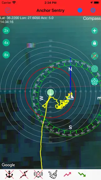
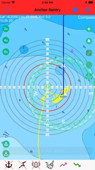
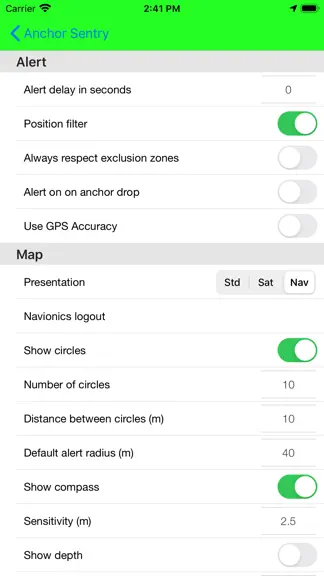
Anchor Sentry is an app to monitor the ship's position at anchor and inform the skipper when the anchor is dragging and thus the ship leaves the setup perimeter. Features: - Show current position on GoogleMaps map or Navionics map (To gain access to Navionics maps from this application, users with an active Navionics subscription in the Navionics Boating application must register with their Navio…
Trends & analysis
Chart rank trend
US · categoryWhy it's surfacing
Scout 12Ratings & velocity
★ 0 in windowRating distribution
50% positive · 4 ratingsGeographic reach
best rank · 6 storefrontsRevenue & downloads trend
ARPU $3Update history
4 updates tracked- v2.11.324d ago
- Fixed the alert and anchor state shown on the mirroring/proxy server sometimes getting stuck after an alarm was acknowledged, even though the boat was no longer in an alarm condition. The current state is now sent immediately when an alarm ends or transmission is stopped, and is repeated on every transmission instead of only when it changes locally, so a single lost update can no longer leave the server out of sync permanently. - Long-tapping a saved anchor place on the map now offers "Show Picture(s)" (if any are saved for that place) and "Edit". Pictures open directly in a new, simple full-screen viewer with the picture's description shown underneath, without going through the place editor. - Fixed a possible app hang at startup. Navionics initialization is no longer done synchronously during app startup, and a redundant, near-immediate rebuild of the Navionics map screen right after launch has been removed.
- v2.11.229d ago
- Improved import/export compatibility for exclusion zones after the Posidonia changes and fixed imports of exports that contain no place images. - Fixed a possible crash when drawing map overlays such as distance circles and tracks. All positions and radii are now validated before they are passed to the map. - Fixed a memory leak that made the distance circles consume more and more memory with every position update. - Distance and radius inputs in the anchor dialog are now limited to their valid range. - Track drawing on the map was moved completely to the main thread to prevent rare, sporadic crashes. - Fixed a possible crash on iOS 18 when a dialog was presented while another dialog was still opening or closing. Dialogs now wait until the previous one has finished instead of being lost or crashing the app. - The alarm circle, shore circle, anchor and anchor places can now be grabbed on the map at any zoom level. The touch tolerance scales with the zoom level instead of being a fixed distance in meters.
- v2.11.11mo ago
- Restored the warning dialog when location permission is insufficient, for example when it is not set to "Always". - Added an optional position accuracy filter that ignores positions above a configurable accuracy limit and can warn about poor GPS reception. - Stopping a triggered anchor alarm is now more reliable. When an alarm is acknowledged from the notification, it will not immediately start again while the boat is still outside the alarm circle. A new alarm can only be triggered after the position was back in the safe area first.
- v2.112mo ago
- Added a new optional setting Show picker in dialog to choose between the previous in-cell pickers scrolling to change values in the settings and a larger picker dialog. - Added dedicated position filter settings (master filter, speed filter, distance filter, distance threshold and time delay) in a separate filter settings page. - Updated position processing to use the new filter options for speed and distance jump handling. - Added Posidonia support in exclusion zones: Posidonia polygons can now be downloaded from Spanish authority data for the currently visible sea area and stored as zones. - Posidonia zones are shown on the map for orientation but do not trigger alarms. - Mirroring: Fixed a connection recovery issue when switching from onboard Wi-Fi to cellular data (e.g. LTE). The receiver now reconnects the WebSocket link more reliably. - Proximity alert/mirroring: When transmission is stopped while the server connection remains active for the proximity alert, the connection is now kept in proxy mode correctly and no longer restarts normal transmitting after a later reconnect.
Anchor Sentry — FAQ
How much money does Anchor Sentry make?
According to AppCurrents estimates, Anchor Sentry generates approximately $3–$50 per month (medium confidence), modeled from its the App Store chart performance, rating velocity, and monetization signals.
How many downloads does Anchor Sentry get?
Anchor Sentry sees an estimated 2–9 downloads per month on the App Store, per AppCurrents modeling.
Is Anchor Sentry free?
Anchor Sentry is a paid app priced at $3.99 on the App Store.
What is Anchor Sentry's rating?
Anchor Sentry holds a 4.00-star average from 4 ratings on the App Store. It currently ranks #94 on the Navigation paid chart.
When was Anchor Sentry released?
Anchor Sentry launched on the App Store on 08.08.2018. Its latest version shipped 11.07.2026.


