Alpin Quest PRO – Outdoor GPS
Alpin Quest PRO – Outdoor GPS generates an estimated $2k–$27k/month in revenue from 400–2k downloads/month on the App Store, according to AppCurrents estimates (updated 2026-10-03).
| Est. revenue / month | $2k–$27k |
|---|---|
| Est. downloads / month | 400–2k |
| Estimate confidence | medium |
| Pricing | Paid $9.99 |
| Rating | 4.73 ★ (11 ratings) |
| Category | Navigation |
| Best chart rank | #35 Navigation Paid |
| Released | 23.03.2026 |
| App last updated | 29.09.2026 |
| Platform | iOS |
Modeled monthly estimate · rating velocity · medium confidence
About
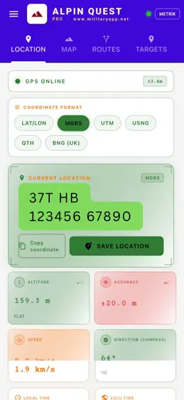
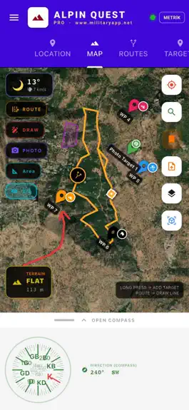
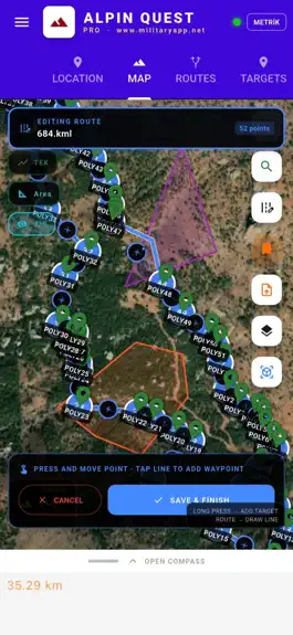
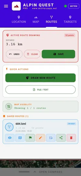
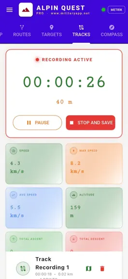
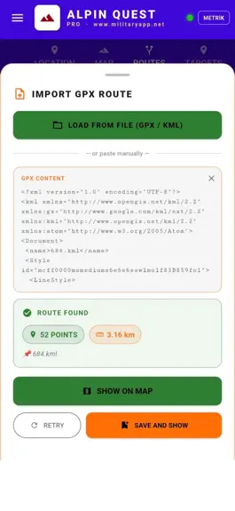
ALPINE QUEST PRO - Outdoor GPS Alpine Quest is an advanced GPS navigation and field management application developed for military personnel, geological and survey engineers, field staff, tactical units, mountaineers, hunters, and off-road professionals. It is used worldwide with 32-language support. Using ArcGIS and QGIS project files. MILITARY & TACTICAL USE MGRS (Military Grid Reference System)…
Trends & analysis
Chart rank trend
US · categoryWhy it's surfacing
Scout 30Ratings & velocity
★ -0.27 in windowRating distribution
100% positive · 1 ratingsGeographic reach
best rank · 1 storefrontRevenue & downloads trend
ARPU $7Update history
12+ updates tracked- v10.0.60+19503d ago
Based on your feedback, we have prepared a major update that makes Alpin Quest PRO more practical, faster and more reliable in the field. Highlights: MAP SCREEN - Full screen: Expand the map to the whole screen with the new button at the bottom right, and return with a single tap. - Go to my location: A separate, larger button at the bottom right takes you back to your position with one tap. - Loaded maps: View, manage and reorder your offline maps (MBTiles, GPKG, GeoTIFF, GeoPDF), raster KMZ files, vector layers (KML, KMZ, DXF) and GPX layers directly from the map, without opening the Load Map tab. - Folder panel: Use the folder button at the bottom right to reach Project, Routes, Waypoints, Areas, Briefing and Tracks without leaving the map, even in full screen. - Map grid: Choose Off, Lat/Lon or UTM/MGRS (km) in the Location tab; show line values and square names, and adjust the grid colour and thickness. COMPASS AND LOCATION - The compass now supports True North, Grid North and Magnetic North; manage your preference in the Location tab. - Real-time position: Find a point by entering a bearing and distance, or create a new waypoint by bearing and distance from a saved waypoint. WAYPOINTS, TRACKS, AREAS AND BRIEFING - Waypoint names: The simplification in the previous update did not suit every user. You can now set waypoint names to on, off or scale-based, from the Location tab or the Waypoints tab settings. - The Tracks tab has been redesigned: recorded tracks now have folders and bulk selection, and you can name your track when you stop recording. - Bulk selection and bulk actions have been added to the Areas and Briefing tabs; lag in the Areas tab with large files has been fixed. FILES AND MAPS - Files from WhatsApp: When you open a KML, KMZ or other map file sent by a friend with the app, it recognizes the file type and takes you to the right place, or asks where you want to load it. - Loaded vector maps can now be hidden, deleted or made transparent directly from the map. - Hide the white background of GeoPackage maps to see the map underneath, and open several maps at the same time. - Files with multiple records at the same location (for example samples taken in different years) are now imported completely. - The map no longer freezes with large files containing many lines. PDF MAP EXPORT - The PDF export has been renewed: choose what to print on the map (waypoints, routes, areas, briefing drawings, loaded maps, your location) and the grid, and preview the PDF in the app before sharing. HELP - The user guide has been updated and can be opened in the app from How to Use in the side menu. Thank you for your feedback. Have a great time in the field.
- v10.0.50+18008d ago
Hello, We developed this update largely based on your feedback. We took note of everything you shared in the comments, emails, and messages we received directly from the field. Thank you for your time. FIELD TEAM MODE The most requested feature is here: everyone working on the same team now sees the same data. The goals, routes, tracks, areas, and briefings you link to a project are synced to your teammates’ devices along with the folder structure. Any edits you make are updated on their devices as well. You retain control: administrators and editors can add and modify data, while observers can only view it. Privacy is clear: only projects you’ve opened to the team are shared. Not even the names of your personal folders leave your device. ATTRIBUTES ARE NOW PROTECTED The field information in GIS files you import from external sources (sample number, analysis value, permit information, and the like) used to appear as unformatted text in the notes section. Now, it appears properly in the metadata of targets, routes, and areas. Tap to view the list, edit from there, or add new fields. They’re also shared via Team Mode. Larger files can now be made editable. LANDSCAPE MODE When you turn your phone sideways, the app rotates too. BATCH ICON CHANGE FOR DESTINATIONS You can change the icon for all destinations in a folder with a single tap— no need to go through hundreds of destinations one by one. Folders you’ve closed remain closed when reopened. The Destinations tab no longer reloads every time you open it. DOSSIERS DANS LES PARCOURS Les tracés enregistrés peuvent être classés dans des dossiers : attribuez-leur une couleur, choisissez une icône, affichez-les ou masquez-les tous sur la carte d'un simple geste. Vous pouvez associer l'intégralité du dossier à un projet ou l'exporter dans un seul fichier ; les données d'altitude sont également incluses dans le fichier. Les tracés que vous laissez visibles sur la carte restent visibles lorsque vous fermez puis rouvrez l'application. TEXTE SUR LA CARTE Vous pouvez ajouter du texte librement à l'endroit de votre choix sur la carte. Choisissez sa couleur et sa taille, puis placez-le dans un dossier. Il est partagé avec l'équipe et apparaît dans les fichiers que vous exportez.
- v9.0.37+115018d ago
Import from another app Open your AlpineQuest files directly. Targets, tracks and routes arrive with their folders. Large files Large GPX backups now load without freezing. Slope information Measurements show the slope between two points. Tap a saved slope route or measurement to see its elevation profile.
- v9.0.36+110022d ago
Dear AlpinQuest users, This version was shaped by your requests and feedback. DXF support Import and export CAD and survey files. Route elevation profile Gradient chart, uphill-downhill split, estimated time and pace. Magnetic declination Sign and decimals corrected. CK-42 coordinates X and Y axes put in the correct order. Arabic interface Coordinate entry and tool button placement fixed. Map labels Overlap resolved, coordinate text can be enlarged.
- v9.0.35+108525d ago
This release was shaped by your feedback. Drawing and editing — made easier Routes and movement — improved Projects — multi-project support added Folders — added to Areas and Briefings Symbols — expanded Coordinates and scale — new options added Surroundings view — peaks and passes through the camera General — smoother performance Happy exploring.
Alpin Quest PRO – Outdoor GPS — FAQ
How much money does Alpin Quest PRO – Outdoor GPS make?
According to AppCurrents estimates, Alpin Quest PRO – Outdoor GPS generates approximately $2k–$27k per month (medium confidence), modeled from its the App Store chart performance, rating velocity, and monetization signals.
How many downloads does Alpin Quest PRO – Outdoor GPS get?
Alpin Quest PRO – Outdoor GPS sees an estimated 400–2k downloads per month on the App Store, per AppCurrents modeling.
Is Alpin Quest PRO – Outdoor GPS free?
Alpin Quest PRO – Outdoor GPS is a paid app priced at $9.99 on the App Store.
What is Alpin Quest PRO – Outdoor GPS's rating?
Alpin Quest PRO – Outdoor GPS holds a 4.73-star average from 11 ratings on the App Store. It currently ranks #35 on the Navigation paid chart.
When was Alpin Quest PRO – Outdoor GPS released?
Alpin Quest PRO – Outdoor GPS launched on the App Store on 23.03.2026. Its latest version shipped 29.09.2026.
Apps like Alpin Quest PRO – Outdoor GPS
See all alternatives → Google MapsNavigation · $750k–$4.0M/mo
 Transit • Subway & Bus TimesNavigation · $570k–$3.1M/mo
 onX Hunt: GPS Hunting MapsNavigation · $350k–$1.2M/mo
 onX Offroad: Trail Maps & GPSNavigation · $110k–$610k/mo
 Citymapper: All Live TransitNavigation · $60k–$330k/mo
 Trucker Path: Truck GPS & FuelNavigation · $51k–$280k/mo