
Acrea: GPS Land Area Measure
Acrea: GPS Land Area Measure generates an estimated $0/month in revenue from 0 downloads/month on the App Store, according to AppCurrents estimates (updated 2026-08-02).
| Est. revenue / month | $0 |
|---|---|
| Est. downloads / month | 0 |
| Estimate confidence | low |
| Pricing | Free + IAP |
| Rating | 0.00 ★ (0 ratings) |
| Category | Navigation |
| Released | 10.06.2026 |
| App last updated | 09.07.2026 |
| Platform | iOS |
Modeled monthly estimate · rating velocity · low confidence
About
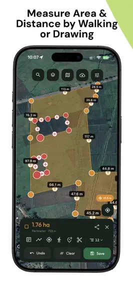
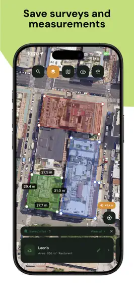
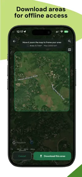
Measure any plot of land in seconds. Acrea turns your phone into a precise GPS area, distance, and perimeter measuring tool - perfect for farmers, surveyors, real-estate agents, roofers, and anyone who needs accurate land measurements on the go. Walk the boundary with live GPS or tap points on a satellite map, and Acrea instantly calculates the area and perimeter in the units you choose. No paper…
Trends & analysis
Chart rank trend
US · overallWhy it's surfacing
Scout 29Ratings & velocity
★ 0 in windowGeographic reach
best rank · 1 storefrontRevenue & downloads trend
monthly estimateIn-app purchases
3 tiersUpdate history
4 updates tracked- v1.3.126d ago
The biggest Acrea update yet - a full parcel-editing toolkit, plus data import. NEW PARCEL TOOLS • Subdivide - carve a parcel into a grid of equal lots by count or size, rotated to any angle. • Split - divide an area in two with a clean cut, or solve for a target lot size. • Merge - fuse adjacent parcels into one. • Trim - subtract one parcel from another. • Move - drag a whole measurement, or offset it by an exact bearing & distance. • Curve – Curve any parameter to fit your actual boundaries. • Import your data - bring parcels in from KML, KMZ, GeoJSON, CSV, DXF or Shapefile. • Duplicate any measurement in a tap. • Tap a saved parcel on the map to select and edit it. • Organize related parcels into groups. ALSO NEW • Bulk export - many measurements, or all of them, in one file (PDF, KML/KMZ, GeoJSON, CSV, DXF, Shapefile) • Smart Coordinate Converter - Decimal Degrees, DMS, MGRS, UTM and Plus Codes. • On-map digital compass with a live magnetic bearing. • Interior angle readouts at every corner. Thanks for using Acrea - keep the feedback coming!
- v1.3.029d ago
The biggest Acrea update yet - a full parcel-editing toolkit, plus data import. NEW PARCEL TOOLS • Subdivide - carve a parcel into a grid of equal lots by count or size, rotated to any angle. • Split - divide an area in two with a clean cut, or solve for a target lot size. • Merge - fuse adjacent parcels into one. • Trim - subtract one parcel from another. • Move - drag a whole measurement, or offset it by an exact bearing & distance. • Curve – Curve any parameter to fit your actual boundaries. • Import your data - bring parcels in from KML, KMZ, GeoJSON, CSV, DXF or Shapefile. • Duplicate any measurement in a tap. • Tap a saved parcel on the map to select and edit it. • Organize related parcels into groups. ALSO NEW • Bulk export - many measurements, or all of them, in one file (PDF, KML/KMZ, GeoJSON, CSV, DXF, Shapefile) • Smart Coordinate Converter - Decimal Degrees, DMS, MGRS, UTM and Plus Codes. • On-map digital compass with a live magnetic bearing. • Interior angle readouts at every corner. Thanks for using Acrea - keep the feedback coming!
- v1.2.11mo ago
The biggest Acrea update yet - a full parcel-editing toolkit, plus data import. NEW PARCEL TOOLS • Subdivide - carve a parcel into a grid of equal lots by count or size, rotated to any angle • Split - divide an area in two with a clean cut, or solve for a target lot size • Merge - fuse adjacent parcels into one • Trim - subtract one parcel from another • Move - drag a whole measurement, or offset it by an exact bearing & distance • Import your data - bring parcels in from KML, KMZ, GeoJSON, CSV, DXF or Shapefile • Duplicate any measurement in a tap • Tap a saved parcel on the map to select and edit it • Organise related parcels into groups ALSO NEW • Bulk export - many measurements, or all of them, in one file (PDF, KML/KMZ, GeoJSON, CSV, DXF, Shapefile) • On-map digital compass with a live magnetic bearing • Interior angle readouts at every corner Thanks for using Acrea - keep the feedback coming!
- v1.1.31mo ago
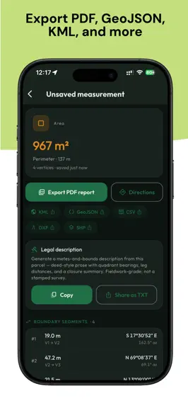
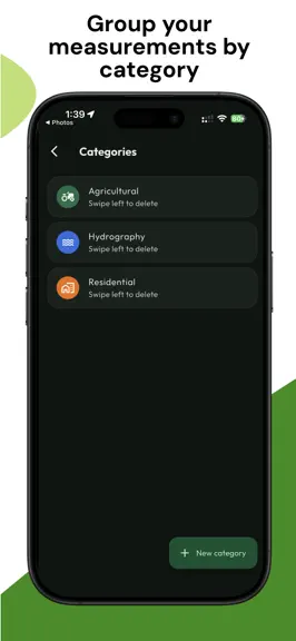
Acrea is now a full pocket surveying tool. New in this release: • Walk-to-measure - record a boundary by walking it, with live area updates • COGO traverse entry - enter boundaries by bearing & distance with a closure check • Legal descriptions - generate metes-and-bounds, deed-style text from any parcel • Precise coordinate entry - type the exact latitude/longitude of any corner • Cut-out areas - subtract ponds, buildings or inner regions from the total • Professional exports - PDF, CAD (DXF), GIS Shapefile, KML, GeoJSON & CSV • Organize saved sites into colour-coded categories Thanks for using Acrea - keep the feedback coming!
Acrea: GPS Land Area Measure — FAQ
How many downloads does Acrea: GPS Land Area Measure get?
Acrea: GPS Land Area Measure sees an estimated 0 downloads per month on the App Store, per AppCurrents modeling.
Is Acrea: GPS Land Area Measure free?
Acrea: GPS Land Area Measure is free to download on the App Store, monetizing through in-app purchases.
When was Acrea: GPS Land Area Measure released?
Acrea: GPS Land Area Measure launched on the App Store on 10.06.2026. Its latest version shipped 09.07.2026.


